"Live" Map of Pittsburgh Bus Service
This is a really great map of the Pittsburgh-Area with a data overlay. It shows the live location of all GPS-enabled Port Authority Transit (PAT) Buses.

This is a really great map of the Pittsburgh-Area with a data overlay. It shows the live location of all GPS-enabled Port Authority Transit (PAT) Buses. It is mostly “live”; there is maybe a 10-30 second delay.
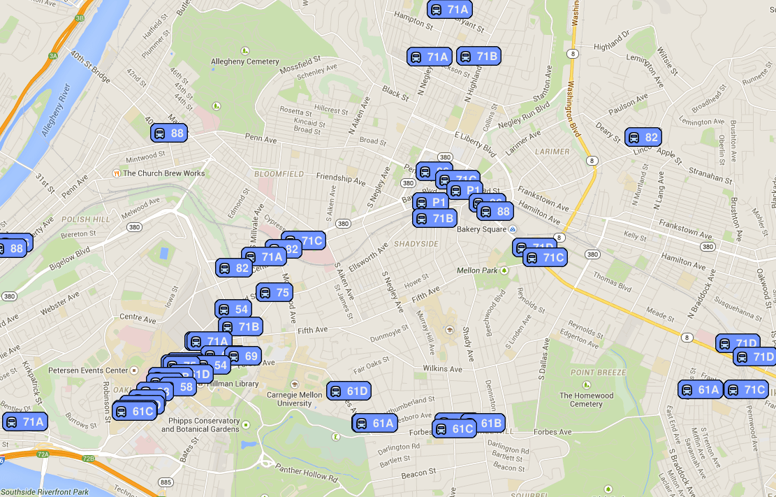
In the screenshot above (from a mid-morning weekday), it is neat to see the clustering effect of all the buses – I expected a city-wide transit service to be fairly even in its spread across the city. But that is not the case. You can see how buses aggregate along the routes. I tracked four “75” buses (not shown in my screenshot); two were in Aspinwall/WaterWorks area and two were on Fifth Ave in Oakland, each pair about a block apart.
If these four buses were evenly distributed across their route, riders would have relatively quick access to one of those four whenever they came out to a stop. However, with the four clustered in two pairs, entire regions of the route are underserved for long stretches. How could we solve this?
This website is described as a “small weekend hack” by creator “Alpire” (from Reddit – where else?). The Reddit thread on this project also links to some resources, including why there is a slight lag and also another hack up of the bus map by Reddit user Emgram769.
Emgram769’s map (below) allows users to select (albeit from a small pool of buses) which specific bus(es) they are interested in tracking. While this does not give you the “big data” view that Alpire’s map gives, it is a really nice way to just get the information you need about a particular bus. Also, it shows the direction that the bus(es) is/are traveling.

Note that on Emgram769’s screenshot (taken in the early afternoon), the 75 buses are more evenly spread along their route. This is great. I wonder if the clustering I noticed on Alpire’s screenshot was an effect of the early morning rush?
The Port Authority does have a map of their own. It works great and seems very useful. It is great that the data has been made available for use by local folks who can hack together their own “weekend projects”, and put out on the web. It forces PAT to be flexible and responsive, and also can give them great ideas for their own resource.
